Spatial analysis and cartography
I’ve always been a fan of maps in all their various formats, from calf-skin to digital. Consequently, I hold an MSc in Geographic Information Systems and I worked for several years for environmental consulting companies. Since then I’ve developed many research web mapping services, of which a small selection are linked to below.
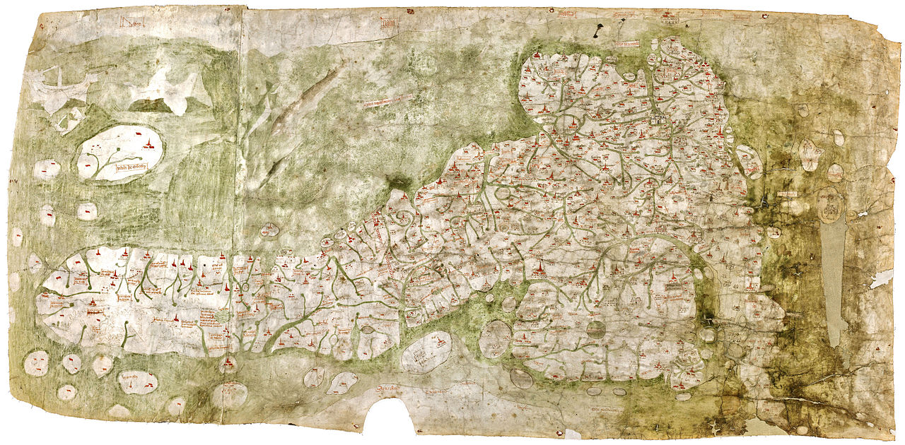
Linguistic Geographies: The Gough Map of Great Britain
Joining KCL in 2011 gave me a chance to explore the earliest map of the UK (at least in a vaguely recognisable form) as part of the Linguistic Geographies project. For my part in the project, I brought the amazing Gough Map into a web interface, to be freely explored and examined but also making expert curation available
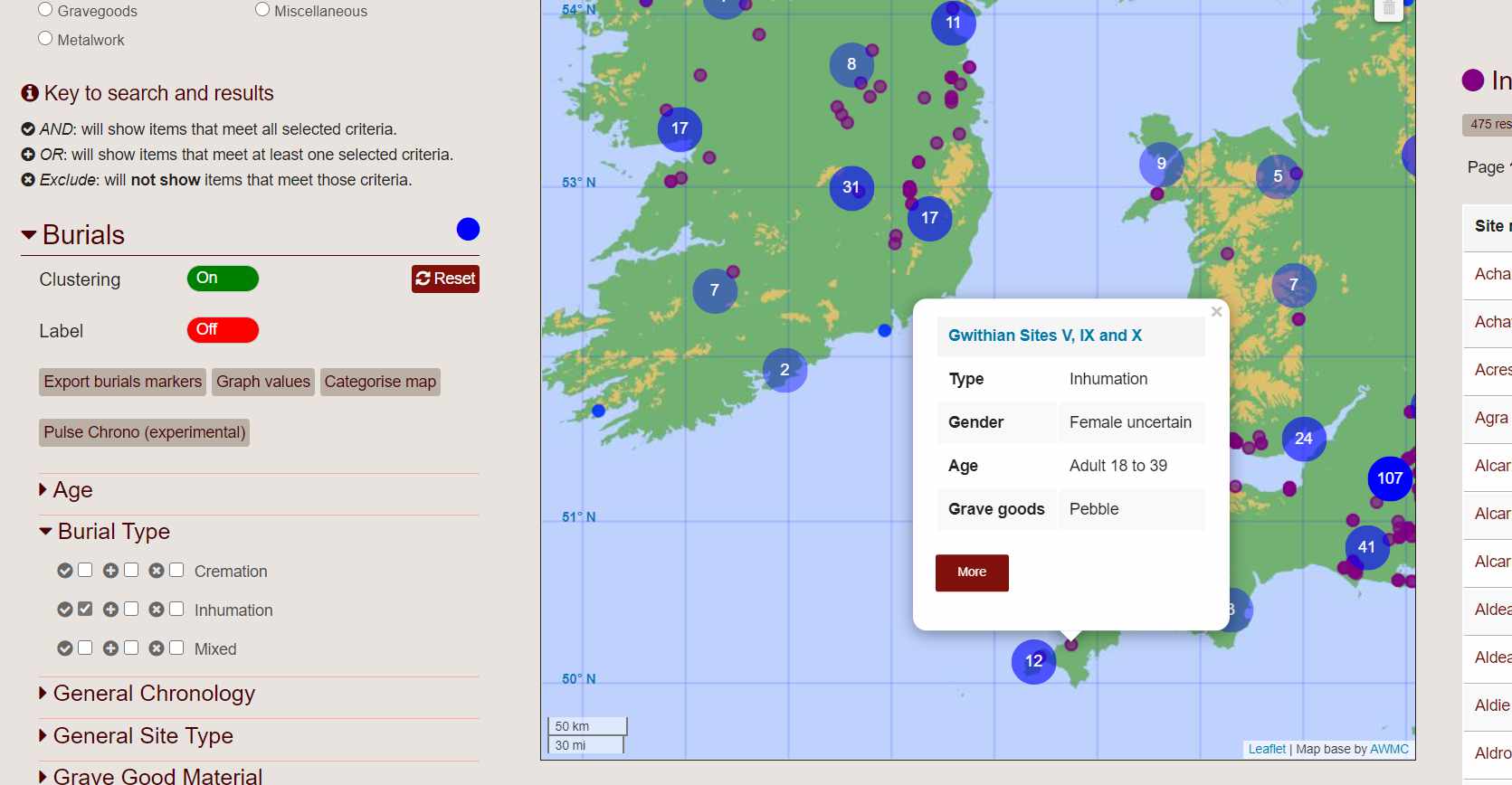
Atlantic Europe in the Metal Ages
Archaeology has always been an interest and I worked with an incredible team, including Sir Barry Cunliffe, to create a digital research platform for exploring the archaeological and linguistic evidence of the origins and trajectory of the proto-Celtic languages. The AEMA map search and database contains (at the time of writing) 4574 burial sites, accounting for 8656 individual burials, and over 10,000 grave goods and pots. It continues to grow and be an important research tool beyond the end of the original project in 2016.